ImageBase
Unites States other than Virginia
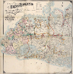
Map of Long Island, New York, Section 1
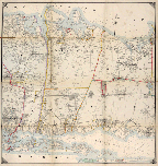
Map of Long Island, New York, Section 2
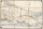
Map of Long Island, New York, Section 3
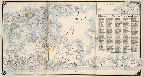
Map of Long Island, New York, Section 4

North Carolina Railroad, Salem to Greensboro
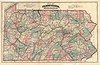
Map of Pennsylvania
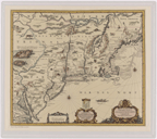
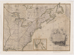
Belgii Novi, Angliae Novae, et Partis Virginiae
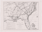
Virginiae Partis Austalis, et Floridae Partis Orientalis
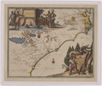
Virginiae Partis Austalis, et Floridae Partis Orientalis
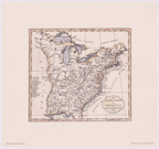
Map of the United States in North America: with the British, French, and Spanish Dominions Adjoining . . .
Part of the United States of North America. Weld
Map of the Southern States of America.
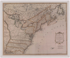
The United States of America According to the Treaty of Peace of 1784.
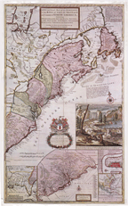
A New and Exact Map of the Dominions of the King of Britian on the Continent of North America.
Carte des Etats-Unis de l'Amerique, Suivant de Traite de Paix de 1783.
Southern Section of the United States, Including Florida
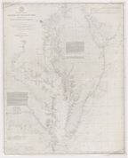
General Chart of Delaware and Chesapeake Bays and the Seacoast from Cape May to Cape Henry

Map of the
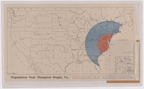
Population Near Hampton Roads, Va.
Master Development Plan Blue Ridge Parkway and Parks
