ImageBase
Click on the image for full size view.
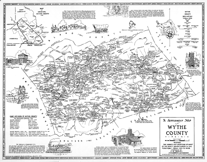
| URN | wythe0001 |
|---|---|
| Work Type | map |
| Title | Wythe County, Virginia: a settlement map from 1745 to 1858 |
| Creator | J. R. Hildebrand, cartographer |
| Subject | New River Valley,Southwestern Virginia,maps |
| Work Date | 1974 |
| Current Site | CD: DLA 018 also LH NRV Maps WYTHE0001.tif |
| Notes | Information from F. B. Kegley, annotations in 1974 by Mary B. Kegley, Dublin, VA. |
| Format | image/gif |
| Owner | Contact Special Collections. |
