ImageBase
Click on the image for full size view.
| URN | HM200611031139 |
|---|---|
| Work Type | Map |
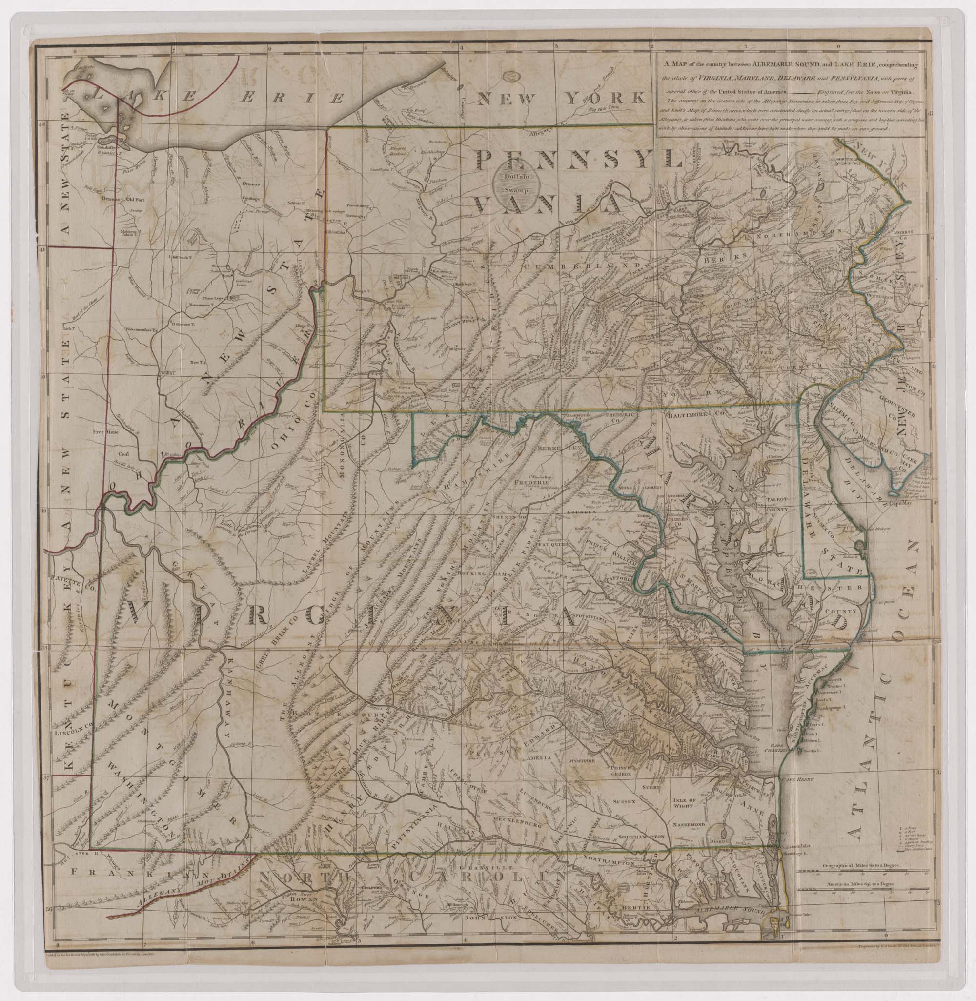
| Title | A Map of the Country Between Ablemarle Sound and Lake Erie, Comprehending the Whole of Virginia, Maryland, Delaware, and Pennsylvania. |
| Subject | Eighteenth Century - Maps |
| Work Date | 1787 |
| Measurements | 24 x 24 in |
| Repository | Special Collections (Virginia Polytechnic Institute and State University) |
| Repository Location | Blacksburg, Virginia |
| Current Site | FOLDER A-2 |
| Type | gif |
| Format | image/gif |
| Measurements | 24 x 24 in |
| Date | 1787 |
| Owner | Contact Special Collections. |
| Copyright | Contact Special Collections. |
| Subject | Eighteenth Century - Maps |
| Source | Special Collections, Historic Map Collection |
