ImageBase
Southwestern Virginia Maps (182 photos)
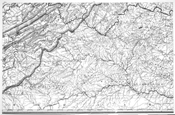
Map of Virginia
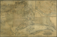
Map of City of Richmond, Virginia
Virginia Anthracite Coal Company Brush Mountain Property, Montgomery County, Va
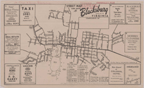
Street Map and Guide to Blacksburg, Virginia.
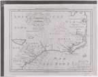
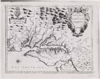
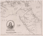
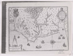
Virginia et Florida
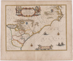
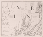
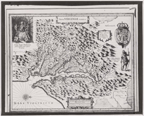
Virginiae Partis Austalis, et Floridae Partis Orientalis
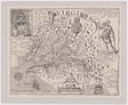
Virginia and Maryland as it is Planted and Inhabited This Present Year 1670.
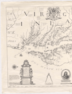
Virginia and Maryland as it is Planted and Inhabited This Present Year 1670. ,
Virginia and Maryland as it is Planted and Inhabited This Present Year 1670. Augustin Herrman, 1673. . . .
Virginia and Maryland as it is Planted and Inhabited This Present Year 1670. Augustin Herrman, 1673. . . .
Virginia and Maryland as it is Planted and Inhabited This Present Year 1670. Augustin Herrman, 1673. . . .
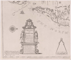
Virginia and Maryland as it is Planted and Inhabited This Present Year 1670. Augustin Herrman, 1673. . . .
Virginia and Maryland as it is Planted and Inhabited This Present Year 1670. Augustin Herrman, 1673. . . .
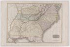
A Map of the Country Between Ablemarle Sound and Lake Erie, Comprehending the Whole of Virginia, Mar . . .
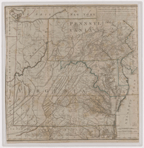
Virginia, West Virginia, North Carolina, South Carolina, and Southern Part of Florida.
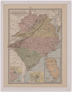
United States of America, Southern Part. From Pinkerton's Modern Atlas
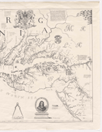
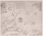
Americae Pars, Nunc Virginia.
Nova Virginiae Tabula. Ca. 17th century. Reproduction;
Virginia. Captain John Smith, (drawn by William Holes). Reproduction;
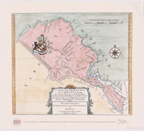
A Survey of the Northern Neck of Virginia, Being the Lands Belonging to the Rt. Honorable Thomas Lor . . .
